Categories
Family Holiday

Tasmania 2018 – Day 7

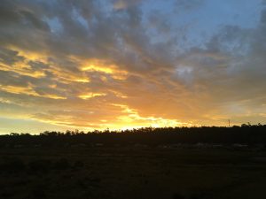
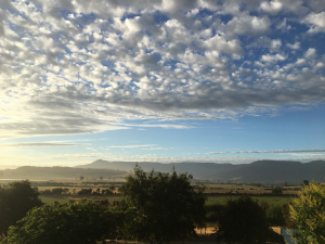
Sunrise - Mole Creek, Tasmania
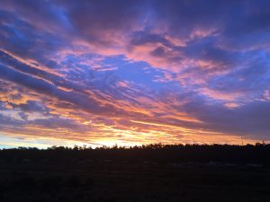
Sunrise – Mole Creek, Tasmania

Cradle Mountain-Lake St Clair National Park – Dove Lake
Another cracking morning greeted us as we departed our accommodation headed for Dove Lake, part of the Cradle Mountain-Lake St Clair National Park. If you’re there early enough, you can drive (cars only, no caravans, campervans or camper-trailers are permitted). Even though we arrive just after 9am, the road was closed and had to take the shuttle bus. The road is too narrow to allow a regular flow of private vehicles throughout the day.
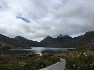
Dove Lake and Cradle Mountain

Dove Lake sits at the foot of Cradle Mountain, one of Tasmania’s most famous landmarks, and a boon for tourists. The Overland Track starts from here (a 6 day hike where you must take everything with you – so popular that during peak seasons you need a ticket to walk the track to ensure numbers are kept to a manageable level).

Cradle Mountain-Lake St Clair National Park is part of the Tasmanian Wilderness World Heritage Area, and since it’s a very popular place for tourists, they need to manage the needs of the visitors with the conservation of important ecological areas within the park.
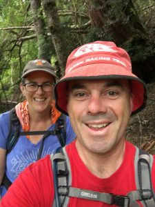
Eva and I walking the Dove Lake trail

We’d decided to do the Dove Lake circuit, a 6km circuit of Dove Lake, which allows great views of Cradle Mountain, Weindorfers Towers and Marions lookout. There weren’t too many people on the track when we went as we’d gotten there relatively early, but it has been known to get busy as the day warms up.
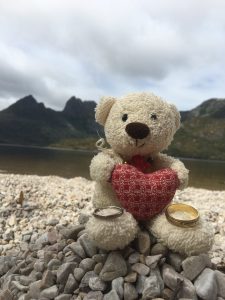
Travel bear with our rings - Dove Lake
Travel bear with our rings – Dove Lake

Part of our visit included re-enacting a wedding proposal by a member of the Australian geocaching fraternity on the shore of Dove Lake. Here, Travel bear (who’s been on many travels with me over the last 19 years) is showing off our wedding rings in the same location the proposal took place.
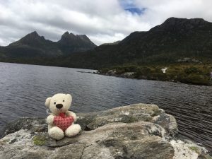
Travel bear & Cradle Mountain

We’d decided against extending our walk up to Marions Lookout (the large mountain to the left of the above picture with Travel bear) as the others were getting tired and the walk is best done when you’re fresh – it’s very rough and steep and the guides advise to avoid that route.

Once we boarded the shuttle bus for the return journey up the hill to the car park, it was time for lunch – we took a short walk from the Ranger station to Knyvet Falls – sadly, no pictures – yet again I was so caught up in the present I didn’t end up taking pictures!
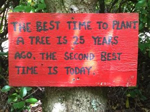
When is the best time to plant a tree?

Tasmazia
After lunch we headed out of the national park and aimed ourselves towards Tasmazia, one of Tasmania’s premier family attractions, and touts itself as the “World’s Largest Maze Complex’. Puzzle/maze places are fun for people of all ages, and after visiting one of them in Arthurs Seat in Victoria on an earlier trip, we gave Tasmazia a go.

Grandparent goal
Grandparent goal

There are 4 physical mazes in here with a number of items to find – in 1 of them, there were at least 10 things to find/visit, whilst the others you had to reach the centre. The kids loved it, and many of the other children in the maze were laughing, giggling and running around the maze – exactly what it’s designed for!
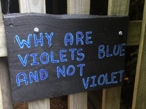
Why are violets blue and not violet? - Tasmazia
Interesting question!

The best part of it (apart from the mazes) is the witty signs dotted around The Great Maze, of which a few of them have been sprinkled through this post. We spent over an hour at the place and were thoroughly tired by the end of it – we’d ended up walking about 10km in total.
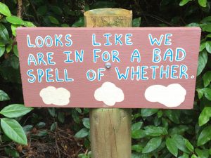
Spelling and grammar are important skills

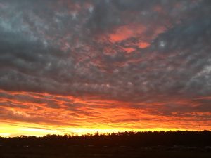
Another great sunset rounded out the day!
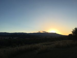
Sunset - Mole Creek
Sunset – Mole Creek

Tomorrow: We travel to Devonport
Yesterday: Tasmania 2018 – Day 6
Categories
Family Holiday

Tasmania 2018 – Day 6
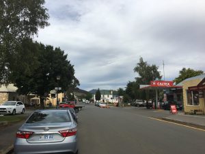
Miena to Mole Creek via Deloraine

Under another blue sky and warming day, we set off from Miena for the small town of Mole Creek, at the foothills of a number of hills/mountains as part of the Great Western Tiers.

Up until now the road surface has been good, patchy and gravelly in a few places (notably on corners where vehicles have dragged rocks and such onto the road), however between Miena and Deloraine there were extensive roadworks, set to last for another year or so (They generally can only work in Summer due to the ever changing conditions in the mountains at other times).

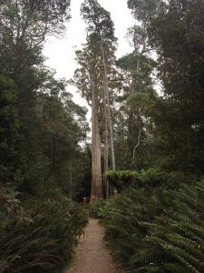
Big Tree, Liffey Falls

Liffey Falls
We decided to stop along the road to Deloraine at our first falls of the trip, a place called Liffey Falls. Once we travelled down the narrow, gravel road, we realised that it was up to an hour round trip, which we didn’t have time for, so settled for a visit to Big Tree near the Liffey car park. If you look in the picture really hard, you’ll see Mr12 with his outstretched arms at the bottom left of the tree (as we see it) – showing the scale of the tree.

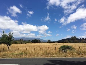
View from Deloraine Visitor's centre
View from Deloraine Visitor’s centre

Deloraine
Deloraine is a lovely arts/creative-centric town in the Highlands of Tasmania, between Launceston and Cradle Mountain. We stopped by the Meander River to eat morning tea and enjoy the summer sun. The town has a number of small sculptures lining the streets, made by local artists.

We visited the information centre and stocked up on maps and info for the locations we were to visit along the way (on many occasions, more can be gleaned from a brochure or book/map than you can get from Google or Siri).

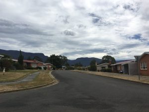
View from Chudleigh Cemetery, Tasmania

We continued West along the Bass Hwy towards Mole Creek,when we stopped by an old cemetery in Chudleigh for Eva to pick up a cache. I love the name “Chudleigh” and found out it’s named after a town in England, the name having come from Saxon origin.

Mole Creek
We soon came across our accommodation for the next 2 nights along the road from Chudleigh – we unloaded our stuff, got a feel for the place then headed off towards the Marakoopa Caves.

Mole Creek Caves (Marakoopa Cave)
There are 2 caves jointly marketed as the Mole Creek Caves – King Solomon cave and the Marakoopa cave. We opted for the Marakoopa Cave because it offered glow-worms – reportedly the largest gathering of glow-worms in Australia.

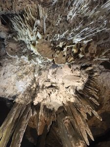
Stalctites, Marakoopa Caves, Tasmania

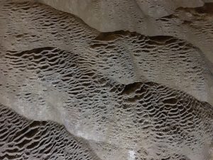
The Marakoopa cave also had an underground river at the end of the cave, a spot to stop and listen (in darkness as well) to the sound of running water. I spotted a fossil on the wall whilst inspecting the cave with a torch.

Marakoopa Caves, Tasmania
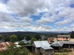
Tulampanga (Alum Cliff), Mole Creek

Tulampanga (Alum Cliff)
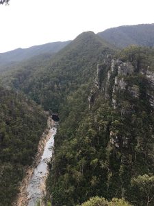
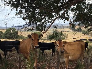
On our way back from Marakoopa Caves we diverted up a hill towards a location referred to as Tulampanga (Alum Cliff). There was a short walk to be completed to get to the lookout over Alum Cliff and the valley and river below (isn’t there always?) On the way down I said hello to a couple of cows!

Cows at Tulampanga, Mole Creek

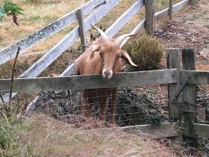
Back to the accommodation for washing, dinner and for Mr12 to play with his new friends – 2 goats and a sheep. I only took 1 photo of one of the goats for your enjoyment 🙂

Friendly goat, Mole Creek

Tomorrow: We’re off to Dove Lake in the Cradle Mountain National Park
Previous: Tasmania 2018 – Day 5

Categories
Family Holiday

Tasmania 2018 – Day 5

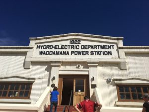
We woke up to another day of beautiful sunshine and blue skies, with the temperature destined to hit the 30’s, we hit the road early to visit the Waddamana Power Station Museum, part of the Tasmanian hydro-electric system.

Penstock Lagoon, Tasmania

Penstock Lagoon
A quick stop at the Penstock Lagoon, the last body of water before it traversed down a long pipeline into the Waddamana Power Station. In the picture above, there used to be a building right where I was standing, on top of the concrete you can see.

Waddamana Power Station A - Waddamana, Tasmania
Waddamana Power Station A – Waddamana, Tasmania

Waddamana Power Station Museum
This place turned out to be the find of the trip so far! As far as tourist attractions go, it was one of the best for a number of reasons:

  • Entry is free (I think they should have a gold coin donation as a minimum as it’s such a well-run place)
  • You can do as much or as little as you want, go at your own pace.
  • The self-tour guide is brilliant, with just enough information about the power station and a description of many of the machinery/equipment
  • The machinery/equipment is well maintained and explained
  • Bernie was very happy to answer questions and provide more information where required
  • Most importantly, I came away more educated than when I went in!
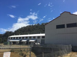
Waddamana Power Station A & B - Waddamana, Tasmania
Waddamana Power Station A & B – Waddamana, Tasmania

The summary of Waddamana Power Station: Along with the Shannon Power Station, they produced 107MW of electricity at their peak in the early 60’s; when the Poatina Power Station came online, it produced almost 3 times the electricity at 313MW! This spelled the end for the Waddamana A and Shannon Power Stations. Hydro Tasmania has done a wonderful job in keeping Waddamana A as a living museum. We’d whiled away a couple of hours here before moving on towards Arthur’s Lake.

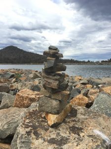
My 11-level cairn - Arthurs Lake, Tasmania
My 11-level cairn – Arthurs Lake, Tasmania

Arthurs Lake
There’s not much here unless you like fishing – the water from Arthurs Lake is pumped into the Great Lake in aid of servicing the Poatina Power Station. After skimming stones, creating another cairn and eating lunch, we decided at that moment to visit the town of Poatina, to see the other end of the process and what took over from Waddamana and Shannon power stations.

Poatina Monument - Poatina, Tasmania
Poatina Monument – Poatina, Tasmania

Poatina
We stopped outside Poatina to view the town’s monument, which looked in need of some TLC – the weather was hot, the wind was dry and hot and stifled you when outside. After looking for the obligatory cache, we drove through the town of Poatina, which had been built in the 60s to house the workers building the power station.

Poatina, Tasmania
Poatina, Tasmania

We were there late on a Friday afternoon in school holidays and the place seemed deserted; almost a ghost town. I got the same eerie feeling I had when I visited Woomera in 2010 as part of the Black Dog Ride. The place looked deserted and the hot, dry wind as well as the land looking brown and barren didn’t do much to change my thoughts. Having said that I am not discounting the work being done by Fusion Australia:

Hydro Tasmania sold the village in 1995 to Fusion Australia, an Australian Christian Youth and Community organisation that works with young people and their communities throughout Australia.

We headed home via Mt Blackwood, home to the Poatina Hillclimb, stopping for a picture at the lookout part-way up the hill. The sunset was particularly awesome so you have to take some pics!

Miena Sunset 1
Miena Sunset 1
Miena Sunset 2
Miena Sunset 2
Miena Sunset 3
Miena Sunset 3

Tomorrow: we head to Mole Creek to continue our Tasmanian Highlands adventure!
Previous Day: Tasmania 2018 – Day 4

Categories
Family Holiday

Tasmania 2018 – Day 4

A short day action-wise as we were travelling from Hobart up the middle of the state to Miena – quite close to the geographic centre of the state.

Richmond, Tasmania
Richmond, Tasmania

Richmond
First stop was the historic town of Richmond, about 20 mins North/North-East of Hobart. Richmond was a convict settlement and had important ties to Hobart and Port Arthur. Historically speaking, Richmond is home to the oldest Gaol (Richmond Gaol, built in 1825 with one of its most famous inmates being Ikey Solomon – reportedly the inspiration for for the character of Fagin in Charles Dicken’s Oliver Twist.

Richmond Bridge, Richmond, Tasmania

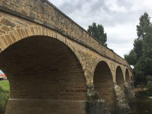
Next up was the oldest convict-built bridge (Richmond Bridge) still operating today – It’s so well constructed that it should still be standing in another hundred or so years. There’s a path from the Gaol to the bridge which runs along the Coal river, where one can simply sit and watch the scenery or feed the ducks. Over the bridge is the old Mill House, where they once milled wheat to become flour, which is now a B&B.

St. John's Church, Richmond, Tasmania
St. John’s Church, Richmond, Tasmania
Inside St. Johns Church, Richmond, Tasmania

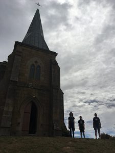
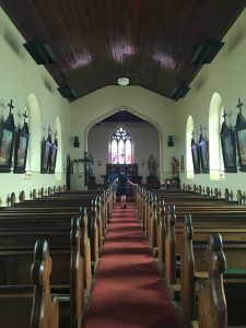
Up the hill a little is Australia’s oldest Catholic Church – St John’s Church, built in 1837. There’s a cemetery behind the church and its position on a hill means it has great views of the town of Richmond. In the pic you can see the silhouette of my family all posing like statues.

Port Arthur memorial at St John's Church, Richmond, Tasmania
Port Arthur memorial at St John’s Church, Richmond, Tasmania

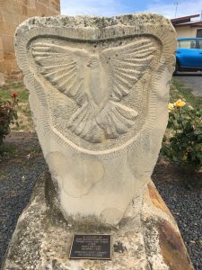
Richmond was established as an important military staging post and convict station linking Hobart with Port Arthur – a small memorial stone next to the church was laid in memory of those who lose their lives at Port Arthur on 28 April 1996. After enjoying a hot chocolate and a lamington at The Bakery, we headed off towards Miena, via a few caches along the way.

On the road to Miena
The drive was fairly uneventful, through small towns such as Bagdad, Kempton and Melton Mowbray(where there was a cache called Cutest Little Chapel), and through Bothwell along the Highland Lakes Road.

Steppes Sculptures, Tasmania

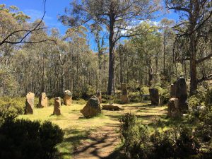
We stopped along the road to view the Steppes Sculptures, a series of stone statues with bronze sections depicting Australian flora and fauna. It seems to be an odd place to have these sculptures but it’s part of a larger historic site you can walk to from the statues.

Miena
At first look, there’s not much to Miena – on second look, it just confirms…there’s not much to Miena! 🙂

It’s a quiet little fishing town on the edge of The Great Lake, in the middle of the state. There’s a Hotel & Lodge (where we stayed), and not much else apart from a number of fishing shacks and houses. The nearest store is about 10km up the road. We checked in and went out for a wander, having seen signs to a number of lakes and dams.

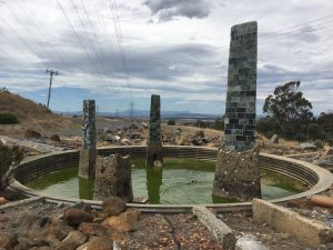
Miena Dam 2 & 3, Miena, Tasmania

Miena Dam(s)
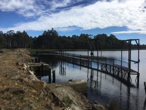
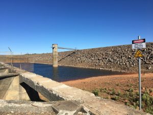
The Great Lake has seen 3 dams built at Miena over the years (later on we pieced together the rest of the story as to what the 3 dams did for the rest of the river system and hydro-electricity in Tasmania). Miena Dam 1 was completed in 1916, Miena 2 in 1922, and Miena 3 in 1982. In the picture you can see Miena 2 the concrete walls in the lower left of the picture and Miena Dam 3, the large stone wall along the right hand side of the picture.

Water glimpse, Central Highlands Lodge - Miena, Tasmania
Water glimpse, Central Highlands Lodge – Miena, Tasmania

We ended the day with a couple more caches before heading home to the Central Highlands Lodge for the night.

Tomorrow we’re off to the Waddamana Power Station Museum and a wander amongst the lakes.
Previous: Tasmania 2018 – Day 3

Categories
Family Holiday

Tasmania 2018 – Day 3

The weather has been glorious so far on our trip – mid 20’s each day, blue skies and barely a cloud in sight. We have been truly blessed by the weather on our trip and it’s made us wonder why we packed cold-weather gear (because it does get cold in Tasmania and in some places, the weather can change relatively quickly). So far we’ve loved the weather and truly relished the chance to get out and about 🙂

Not a big day driving-wise, we headed north from Hobart to the Cadbury Factory (for a cache, not the chocolate – they closed the visit centre a couple of years back), afterwards headed to MONA, the Museum of Old and New Art.

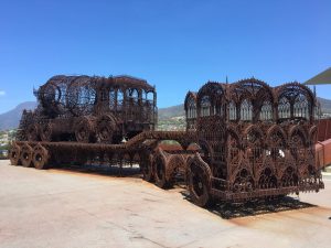
Truck and cement mixer, MONA

MONA

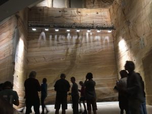
There’s something here for everyone (yes, including you!) , and the art on display is not necessarily art that would make it into mainstream museums. It’s an eclectic collection of art that seeks to confront, shock or make you experience something you’d not necessarily be looking for.

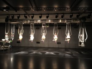
Bit.fall, MONA
Bit.fall, MONA
Cloaca Professional, MONA

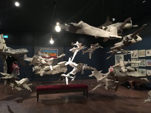
I ended up reading more about the works than taking photos, so much so that I took photos of 5 items, and in a museum of over 1900 items, I could have taken more. Some of my favourites: bit.fall, Cloaca Professional (Who doesn’t like a science-experiment designed to mimic the human digestive system?) and the paper planes – I didn’t get the gist of the story 100% but the Mambo-esque, crude structures that made up the planes gave it a quirky, child-like quality.

Paper Planes, MONA
Paper Planes, MONA

Rosny Hill
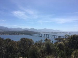
After we departed MONA, we wandered down the road to pickup a cache or two, and head East across the Bowen Bridge, headed for another mountain – this time we aimed for Rosny Hill Lookout – for another cache and yet another view of Hobart!

View from Rosny Hill, Hobart

Battery Point
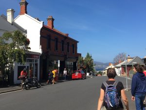
Later, we walked from our ‘home’in Sandy Bay to Battery Point in the afternoon sun, wandering down streets that reminded me of being in a small English village. Eva had organised an impromptu meetup with local geocachers so we headed towards Princes Park, not before finding a couple more caches along the way.

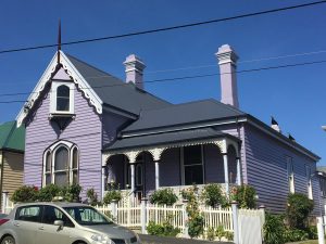
Battery Point, Hobart
Purple house, Battery Point, Hobart

Continuing the tradition of ineffectual Hobart defensive positions, Princes Park is the site of another defence battery (hence the name, Battery Point).

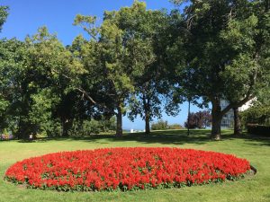
Princes Park, Battery Point, Hobart

Reading the onsite information board, this site had defences built 3 times; the first 2 times they’d positioned it badly and realised firstly that the cannons they had could not reach a ship in the harbour unless it was close; after the upgrade (version 2) they had bigger guns but still could not reach if the ship was too far offshore, and the battery was too open and could draw enemy fire into the residential buildings surrounding the point; so they rebuilt it again, this time realising it was too late with other batteries coming online further towards the sea. Ultimately they never fired in anger and were only used for ceremonial duties.

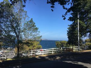
View from Princes Park, Battery Point, Hobart

Previous: Tasmania 2018 – Day 2
Next: Tasmania 2018 – Day 4

Categories
Family Holiday

Tasmania 2018 – Day 2

One of the biggest draw cards for us is Port Arthur, the site of one of Australia’s largest penal colonies. There’s so much to see and take in that your ticket lasts 2 days! An easy 90 minute drive south-east from Hobart, you pass through a number small towns, through forest, bush and farmland. There are plenty of stops along the way for those who need to break up the drive.

Port Arthur

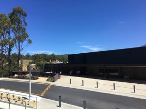
Port Arthur Visitor Centre

The Port Arthur visitor’s centre is a large, dark building with no identity – you can’t miss the building from the car park, however it’s not signposted in any way, not even where the entry is – there’s enough of a story behind the visitor’s centre to warrant the lack of identity.

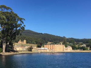
Port Arthur
Port Arthur

There are 2 parts to your entry ticket – an introductory tour and a harbour cruise. We took the harbour cruise first, learning about the origins of Port Arthur as a working port- fresh water, a deep harbour and lots of timber helped it become a boat-building location. The first part of the cruise took us past the site of the first Boy’s prison in the British Empire at Point Puer, as well as the Isle of the Dead where more than 1100 souls were laid to rest.

After the 30 min harbour cruise, we paid our respects to those that lost their lives on April 28 1996 – wandering through a memorial setup to honour those that died in Australia’s worst mass-shooting in history. The site is respectful and quiet – not eerie, just a lovely, tranquil space to think and reflect on what happened more than 20 years ago.
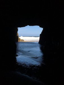
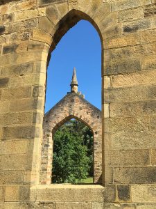
Church windows, Port Arthur

We wandered through the gardens, (recreated from soil analysis) where the children would play and ladies would relax and enjoy themselves, up to The Church (trivia – the church was never consecrated so services of any denomination could take place) and Government Cottage where visiting dignitaries would stay before joining  a tour with tour guide Steve, who explained more about the workings of Port Arthur and its inhabitants over the next 45 minutes.

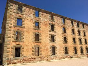
Port Arthur Penitentiary

After the tour, we went back to wandering amongst the buildings ourselves, continuing through the Hospital, Penitentiary, Pauper’s depot , the Separate Prison and the Asylum. Even though Port Arthur’s history includes a combination of civilians, military personnel and convicts, it’s undeniably remembered for being one of Australia’s first and harshest jails.

Overall we enjoyed our time at Port Arthur, trying to imagine how the place operated and was run is difficult in the modern age but they’ve done a great job to share the stories and keep the place running smoothly. If you’re thinking of going, budget the whole day or the better part of 4 hours or so.

Remarkable Cave
Remarkable Cave

Remarkable Cave
After Port Arthur, we went looking for caches, which took us through Carnarvon Bay, and onwards to Maingon Point, where we found Remarkable Cave.

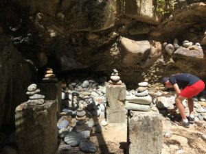
Cairns (rock towers), Remarkable Cave

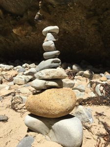
This cave is not far from the road down a few flights of stairs, and at the end you can see many examples of cairns (rock towers) – some on the ground, and others in more audacious spots on the cliff face on rock ledges and gaps in the walls.

My 9-layer cairn, Remarkable Cave
Tasmans Arch
Tasmans Arch

Eaglehawk Neck
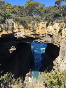
Next stop was at Eaglehawk Neck for fish & chips in a cone (watch the seagulls!), near the youngest-of-3 natural rock formations: The Blowhole (which made a lot of noise but no water-blowing action), it’s older uncle Tasmans Arch (doesn’t do much blow-holing as it’s a natural arch) and the elder of the 3, Devil’s Kitchen (which we didn’t visit).

Pirates Bay, Eaglehawk Neck, Tasmania

Pirates Bay
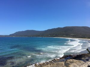
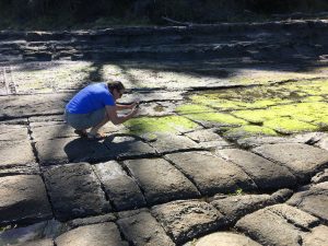
From here, it’s just a short drive to Pirates Bay and the famous Tessellated Pathway, created by nature, leaving a ‘pan’ or a ‘loaf’ in the stone – a pan occurs further from shore when the water dries quickly and leaves a layer of salt behind; a loaf occurs closer to the water where it stays under water for longer (with a shorter drying time) – the salt falls into the cracks and erodes the edges of the stone, thus forming the loaf-shape. During low tide, the resulting stones look like a pathway . In the pic you can see Eva inspecting the pathway a little closer.

Tessellated Pathway
Tessellated Pathway

At the end of our caching and sightseeing, we visited a friend who recently moved to Tasmania from Sydney to begin a motorcycle tour business before heading up another mountain (Mount Rumney) for the view and to find a cache.

Previous: Tasmania 2018 – Day 1

Categories
Family Holiday

Tasmania 2018 – Day 1

We’ve taken our annual holiday to Tasmania, somewhere I’d wanted to get to for many years. Eva was here a number of years ago but it’s the only state I hadn’t visited during my travels in the past. Also, a number of my motorcycling buddies had been to Tassie before, so it was time to do it with the family before doing it with my mates on the bike 🙂

Landed in Hobart early, picked up the rental car – a Blue Toyota Rav4 – the colour is important because it’s not a bland, nothing colour like black, white, grey or silver (or any derivative of these colours). We headed into downtown Hobart via a detour for a cache just outside the airport, which gave me some time to look over the car and uncover where all the controls are.

Jackson's Tunnel
Jackson’s Tunnel

We stopped for pies at Banjo’s – I had a scallop pie, something that most of the guide books advise you to do – not sure if that was morning tea or early little lunch! Walked around the CBD, finding caches and getting our bearings before heading off to Mount Wellington. First stop was a cache called Jackson’s Tunnel, featuring a convict-built sandstone block-tunnel, which was part of Tasmania’s early road system.

Hobart from Mount Wellington

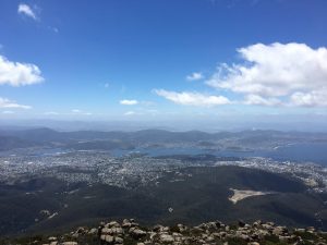
Mount Wellington is a busy place, and arguably has the best views – it’s certainly the closest, tallest mountain overlooking Hobart (which we’ve nicknamed the ‘City of Mountains’ as there are a number of them all around). Flat space in Hobart is not easy to come by! There were quite a few people there and the weather was glorious – clear blue skies and visibility was excellent. On some days the cloud cover is so low you can’t see through it.

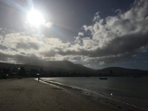
After finding accommodation and buying supplies, we headed off for a little wander around the area and went for a walk along Nutgrove Beach – watched the kite surfers as well as a brave kayaker out on the water – the wind was up and made us feel chilly!

Nutgrove Beach
Nutgrove Beach

We continued our walk along the beach (finding more caches) until it ended and became residential, so we headed up to Alexandra Battery Point, with another amazing view of Hobart/the Derwent River, and wandered through the remains of the battlement that was setup here. Many of the batteries setup were never called into active use. This was one of many batteries setup to protect Hobart, from a threat that never eventuated.

Alexandra Battery Park

Onwards to Mount Nelson – up a residential, steep zig-zag of a road to visit the signal station at the top, and see what we could see. As it’s overlooking Alexandra Battery Park, the views should be somewhat similar – however, this was not the case as it turns out you can see more to the south from here than the other places, but because of the trees and bushland, you couldn’t see much of Hobart or the suburbs at all. And, the former signal station is no longer in use (when was the last time you heard of semaphore signalling?)  As the sun was setting, we made our way to Mount Nelson oval for one last cache before heading to our accommodation for the night.

View from Mount Nelson

Tomorrow, Port Arthur and interesting places along the way.